How to get there?

Location – GPS coordinates:
φ=49º46’36”.16 N, λ=21º05’22”.27 E, h=351 MASL

In principle, there is no road access on site. From all directions the final stages of the roads are dirt roads leading trough forest terrain, often with a muddy surface. The clearing where the Observatory is located is a private property and there is no possibility to park any cars without earlier permission from the owners.
Two road routes are suggested below that lead to starting points of foot tracks towards the Observatory.

Satellite navigation devices in our area often lead trough roads that are not passable. It is suggested to use the Google Maps links below with initially set route that leads trough important intermediate points.

Spis treści

Route 1 – access to a 400m foot track


google-map-icon

GOOGLE MAPS WITH IMPORTANT INTERMEDIATE POINTS
– change the “Parafia rzymskokatolicka NMP” (local church) to your own starting point.

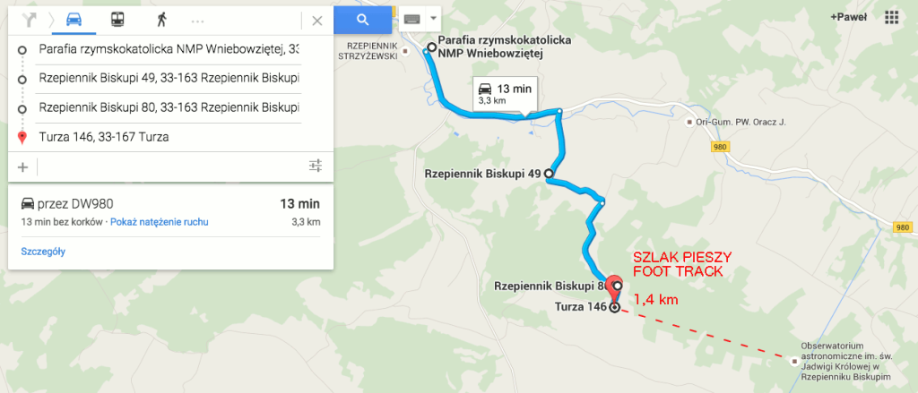
Route 2 – access to 1,4km foot track


google-map-icon

GOOGLE MAPS WITH IMPORTNANT INTERMEDIATE POINTS
– change the “Parafia rzymskokatolicka NMP” (local church) to your own starting point.


Important: the foot track 1,4 km is not present on Google Maps – see the map below: footTrackMap
Print Friendly, PDF & Email
Share

Comments are closed.